Natural Resources

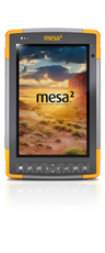
Designed For Natural Resources

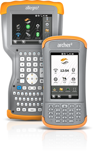
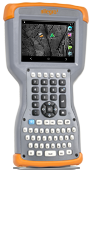
Humid jungles, hot deserts, and frigid landscapes are no match against Juniper Systems rugged tablets and handhelds. Our products are designed to be waterproof, dust proof, able to endure multiple drops to concrete, and function perfectly in the most extreme temperatures. All Juniper Rugged™ handhelds and tablets feature an ultra-rugged design (up to IP68 standards), long battery life, ergonomic composition, and sunlight readable displays.

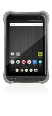
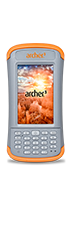
Juniper’s Cedar brand of rugged tablets and handhelds offer a step-up in ruggedness and reliability from consumer-grade products. Running the Android operating system and giving massive bang for your buck, Cedar rugged devices will get your project done on time and on budget.

We are happy to assist you in identifying a reliable hardware/software solution to meet your natural resources mobile data collection needs. Contact Juniper Systems today for information and pricing!

Forestry & Forest Products

Forestry customers are important to Juniper Systems. Forest inventory and log scaling professionals in the Pacific Northwest United States and Canada were among our first customers more than 20 years ago. Today, in addition to forest inventory analysis and log scaling, our products are used worldwide for forestry field data collection applications including lumber grading, timber cruising, wildland fire mapping and management, silviculture, urban forestry, forestry GPS, vegetation and weed mapping, wildlife surveys, and GPS trail mapping. We are happy to assist with identifying solution options for large and small projects. Contact Juniper Systems today for pricing on our ultra-rugged handheld computers!

Rugged Handhelds

Forestry and Forest Product Applications

All Juniper Systems portable data recorders feature an ultra-rugged design (waterproof, dustproof, shockproof), sunlight readable displays, long battery life, ergonomic design, and field-swappable batteries. Options for GPS, cameras with geotagging capabilities, barcode scanner, and RFID are also available.

  • Rugged Field Computers
  • Forest Inventory / Timber Cruising
  • Log Scaling / Lumber Grading
  • GPS And Mapping
  • Forestry Business Partners & Solutions

Forestry Business Partners & Solutions

Laser Technology Inc.

Instantly download all your Laser Technology field data to Juniper Systems rugged handhelds using the standard RS-232 serial port or optional Bluetooth® wireless technology. Juniper Systems rugged handhelds are compatible with LTI MapSmart and Esri ArcPad for GPS offset data capture. Click here to download theTruPulse Laser Rangefinders with Juniper Handhelds data sheet.

Haglof

Haglof produces high quality forest measurement devices that integrate perfectly with Juniper Systems rugged handheld computers.

Geospatial Solutions

Need a GPS fix? Juniper Systems rugged handheld computers are your surefire solution for simple and accurate GPS data collection. There are multiple GPS options for each of our rugged field computers, whether you’re looking for 2–5 meter, sub-meter, or centimeter accuracy. Learn more by downloading our Geospatial Solutions data sheet today.

Not only do we provide the hardware for GIS and GPS applications, we also offer several GPS software packages and compatibility options for other common software in the mapping industry.

GPS Software Available Through Juniper Systems

Juniper Systems is authorized to sell the following GPS software. Please contact us for more information or a price quote.

Landmark Mobile

Landmark Mobile
A simple and affordable GPS software utility that allows users to collect waypoints and integrate data with other software applications. Click here for more information or a free demo download.

Everglade

Everglade Wetland Delineation Software
A comprehensive mobile data collection solution meeting wetland delineation requirements as defined by the U.S. Army Corps of Engineers for tabular and spatial data collection. Click here for more information or a free demo download.

ESRI Arcpad

ESRI Arcpad
An all-inclusive geospatial software allowing users to capture, edit, analyze, and display geographic information. Click here for more information.

effigis Geo Solutions

Effigis OnPoz Precision Positioning Software
A complete suite of applications that allow you to easily and accurately collect, record, and post-process geospatial data for sub-meter GPS accuracy. Click here for more information.

Other GPS Software Compatible With Juniper Systems Rugged Handhelds

Juniper Systems rugged handhelds are designed to be compatible with most major GIS software. As a general rule, if the software supports Windows Mobile OS, Windows 10, or Android, one of our products will most likely be compatible. We believe our GPS customers should not be restricted to certain GIS software or pay for subscription services to access free NMEA data. Feel free to contact Juniper Systems with any questions.

esri

esri Software
Juniper Systems is proud to be an Esri Business Partner. Our rugged handheld computers work together seamlessly with the industry-standard software portfolio provided by Esri.

Cybertracker

Cybertracker
CyberTracker is a free, yet powerful GIS field data collection application that supports the creation of custom mobile forms and GPS points and tracks. CyberTracker has easy-to-use background satellite imagery and a desktop database, and makes it easy to export data to common GIS and data formats such as SHP, KML, and Microsoft® Excel. Click here to learn more.

Star Pal

StarPal™ HGIS
A practical GIS field data collection application that allows users to import and export from GIS, customize field attributes, and integrate sensor data inputs. Click here to learn more.

For additional software options or to confirm software compatibility, please contact us.

Environmental Management Data Collection

Environmental consultants use field computers and mobile GIS/GPS for a myriad of applications while conducting surveys, creating mitigation plans, verifying environmental regulatory compliance, and consulting for federal and state natural and cultural resource management agencies.

Applications Include

  • Environmental Impact Statements
  • Mapping Invasive Species
  • Wetland Delineation
  • GIS Mapping
  • Wildlife Surveys
  • Viewing and Capturing Data from Sensors
  • Riparian Zone Mapping

Juniper Systems rugged handheld computers and intuitive software solution packages offer land managers and environmental consultants a wide range of options for their field computing needs. Our business partners build full solutions or customize solutions for environmental management needs. Please contact us for more information.

Water Resources Data Collection

Juniper Systems rugged handheld computers are used in conjunction with water measurement instrumentation to provide a complete solution for water resource monitoring and measurement.

Applications Include

  • Profiling
  • Surveying
  • Monitoring of Surface Ground Water
  • Water Quality
  • Flow and Level
  • Turbidity
  • Aquifer Storage & Recovery
  • Discharge Monitoring
  • Estuary & Wetland Studies
  • Remediation Projects
  • Saltwater Intrusion Monitoring
  • Storm Surge Analysis

Geospatial position is important when integrating monitoring data into your GIS. Using Juniper Systems' handheld computers with GPS provides location-based information for the GIS.

Juniper Systems' business partners offer a wide selection of solutions for water resource applications. These solutions link water monitoring instrumentation and intuitive software applications with the ultra-rugged handheld computer. Our business partners provide versatile solutions to meet your application needs and can be customized to meet your specific needs.

Geophysical Data Collection

The field of geophysics has dramatically increased our ability to nondestructively survey natural resources through the use of seismic, gravity, magnetic, electrical, and electromagnetic methods in the search for oil, gas, minerals, water, etc.

Geophysicists around the world trust our rugged handheld computers because of their unsurpassed track record in applications prone to environmental abuse, heavy usage, and their ability to capture and protect critical survey data.

Applications Include

  • Geophysical Surveying
  • Geodesy
  • Tectonophysics
  • Geodynamics
  • Shallow Seismology
  • Geomagnetism
  • Environmental Remediation
  • Geological Mapping
  • Archaeological Imaging
  • Environmental Geophysics
  • Engineering Geophysics

Juniper Systems' partners provide a range of solutions combining an application solution with the rugged handhelds for specific geophysical applications. If you are a potential business partner with expertise in one of these fields, please visit our Business Partner page.

Geophysical Business Partners & Solutions

SENSYS GmbH
SENSYS GmbH

SENSYS Sensorik & Systemtechnologie GmbH offers sensitive survey equipment for UXO, archaeological and scientific applications beneath the surface of the ground and water. These systems are tailored to customer needs and durably designed for use in the field to help operators clearly identify detected objects for clearance.

Fisheries Management Collection

Juniper Systems’ rugged handheld computers are ideal for fisheries applications. Used in both marine and fresh water environments, our reliable field PCs are waterproof, shockproof, and operate at extreme hot and cold temperatures. Some of our first handhelds from 20 years ago are still in use today for fish stock monitoring in the Gulf of Alaska!

We are happy to assist you in identifying the most reliable hardware/software solution to meet your fisheries data collection needs. You can even send us a paper form or Excel spreadsheet and we can show you options for creating easy-to-use mobile data entry forms.

Applications Include

  • Stream Surveys
  • Electrofishing Applications
  • Catch & Fish Stock Monitoring
  • GPS Mapping
  • RFID Pit Data Collection
  • Water Quality
  • Research Data Collection
  • Marine Protection Area Monitoring
  • Wireless Fish Measurement Board Solutions

All Juniper Systems handheld field computers feature an ultra-rugged design (waterproof, dustproof, shockproof), sunlight readable displays, long battery life, ergonomic design, and field-swappable batteries. Options for GPS, cameras with geotagging capabilities, barcode scanners, and RFID are also available